
-
Use the command Point to create a point to the current survey subproject in the graphic view.
-
Click Draw.
-
Click Point.

-
Click on graphic view to create the topographic point.
-
You can enable/disable object snap.

-
You can edit the point name, and point coordinate from Point position bar.

-
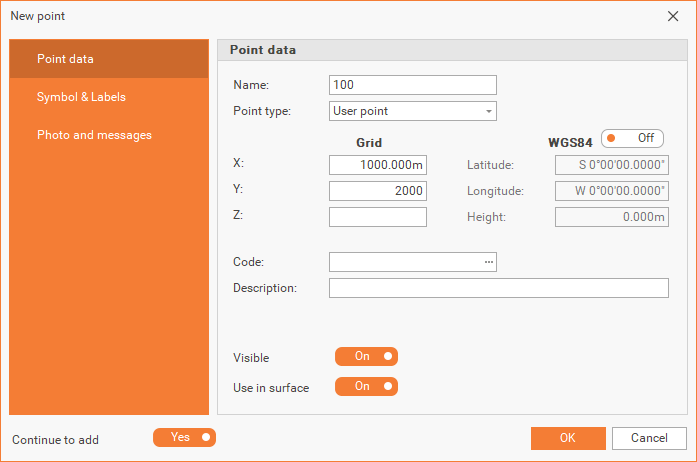
Points can be entered manually:
-
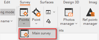
Click on Survey.
-
Click Points and select the Survey subproject.
-
From the new window, click on

-
click on OK once you finish.
-
They can also be added from the Points list, directly by entering the point’s information in the corresponding fields.
