



-
Stored measurements can be visualized and edited from the Measurements list.
-
Open Job tab.
-
Select Points/Measurements/Codes.
-
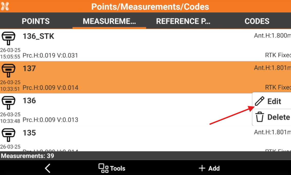
Open the Measurements tab. The page lists the measurements.
-
Tap on a point and select Edit.
-
The data of the point is organised in pages.
Point page
-
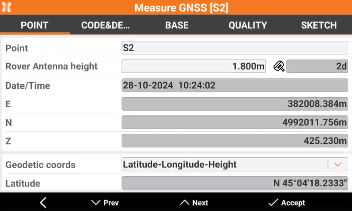
Point page include coordinate information of measured point.
-
Point: name of the point.
-
Rover antenna height: GNSS antenna elevation. When the antenna elevation is changed, the corresponding point coordinates are recalculated.
-
Tilt: in case of use of GNSS receivers with IMU, this field displays the GNSS pole tilt.
-
Target height: TPS target elevation. When the antenna elevation is changed, the corresponding point coordinates are recalculated.
-
Date/Time: date and time when the measurement has been performed.
-
E, N, Z: plane coordinates of the point.
-
Depth: in case of measure with a vertical offset, the depth shows the vertical offset.
-
Geodetic coords: allows to choose the format for the WGS84 coordinate.
-
Latitude, longitude and height: the coordinate is visualized as latitude, longitude and height.
-
ECEF XYZ: the coordinate is visualized as earth centered coordinate.
-
-
Code page
-
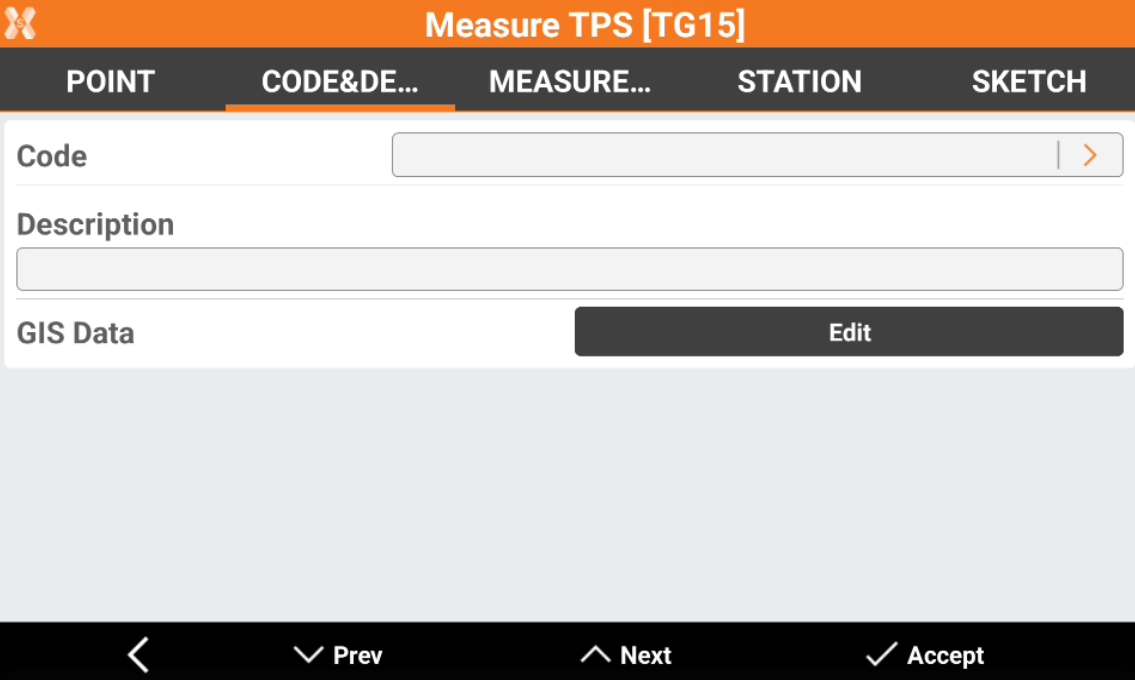
The Code & Description page displays measurement properties such as code, description, and GIS features.
-
Code: survey code of the point. Click > to open the codes library and select a different code from the list.
-
Description: extended description of the point.
-
Date: date and time when the point was stored.
-
GIS Data: if GIS features have been associated to the point click Edit to enter or modify the corresponding GIS attributes.
-
Station (TPS only)
-
Station page is available when working with a total station.
-
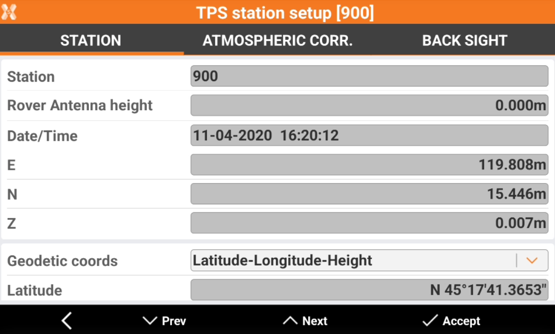
The page shows information on the station setup.
-
Point: name of the station.
-
Station height: station elevation.
-
Date/Time: date and time when the measurement has been performed.
-
E, N, Z: plane coordinates of the station.
-
Geodetic coords: allows to choose the format for the WGS84 coordinate.
-
Latitude, longitude and height: the coordinate is visualized as latitude, longitude and height.
-
ECEF XYZ: the coordinate is visualized as earth centered coordinate.
-
Measurement page (TPS only)
-
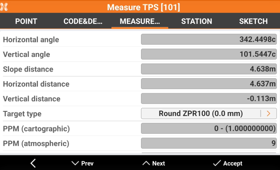
Measurement page shows the properties of the total station measure.
-
Horizontal angle: the measured horizontal angle.
-
Vertical angle: the measured vertical angle.
-
Slope distance: the measured slope distance.
-
Horizontal distance: the measured horizontal distance.
-
Vertical distance: the measured vertical distance.
-
Target type: the type of target used in the measure. Click on the arrow to change the target type used: this operation recalculates the point coordinate.
-
PPM (cartographic): the combined scale factor for ground to grid reduction used for the measure.
-
PPM (atmospheric): the atmospheric scale factor used for the measure.
-
Prism aim mode: the mode used to aim the target.
-
F1/F2 Data (TPS only)
-
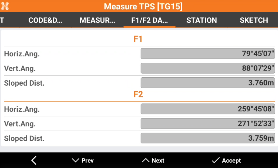
The F1/F2 Data page is available in case of TPS measurements in face I and face II.
-
The page shows the measured data performed in face I and face II.
-
Horiz.Ang.: the horizontal angle measured in face I and in face II.
-
Vert.Ang.: the vertical angle measured in face I and in face II.
-
Sloped Dist.: the sloped distance measured in face I and in face II.
-
Base page (GNSS only)
-
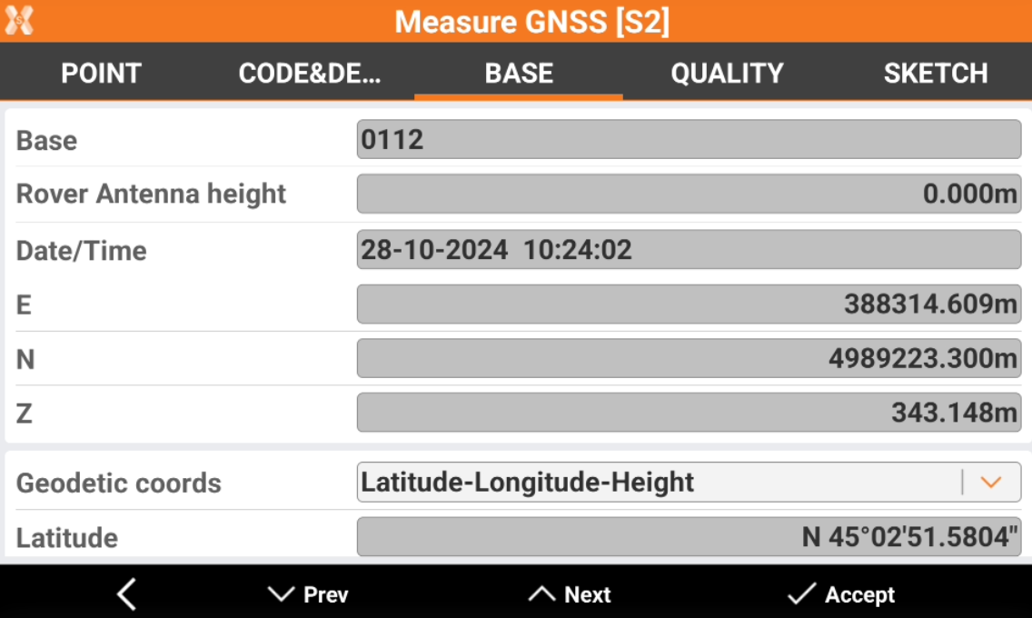
Base page shows the properties of the GNSS base used for the selected measure.
-
The page is available when working with a GNSS receiver.
-
Base: the ID of the base.
-
Base Antenna height: the base height from ground point to ARP.
-
Date/Time: date and time when the measurement has been performed.
-
E, N, Z: plane coordinates of the coordinate of the base.
-
Geodetic coords: allows to choose the format for the WGS84 coordinates of the base.
-
Latitude, longitude and height: the coordinate is visualized as latitude, longitude and height.
-
ECEF XYZ: the coordinate is visualized as earth centered coordinate.
-
-
Quality page (GNSS only)
-
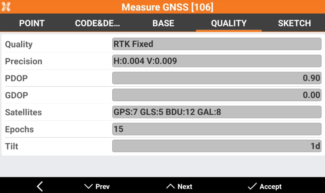
Quality page shows information about the quality of the GNSS measurement.
-
Quality: the quality of the GNSS positioning (RTK fixed, Mobile, Autonomous)
-
Precision: the estimated positioning error in planimetry and elevation.
-
PDOP: the calculated PDOP (positional dilution of precision).
-
GDOP: the calculated GDOP (geometric dilution of precision)
-
Satellites: the used satellites. The number of satellites is subdivided by GNSS constellation (GPS, GLONASS, Beidou, Galileo).
-
Epochs: the number of epochs.
-
Tilt: in case of measure with IMU receiver, this field shows the pole tilt in degrees.
-
Offset distance (TPS only)
-
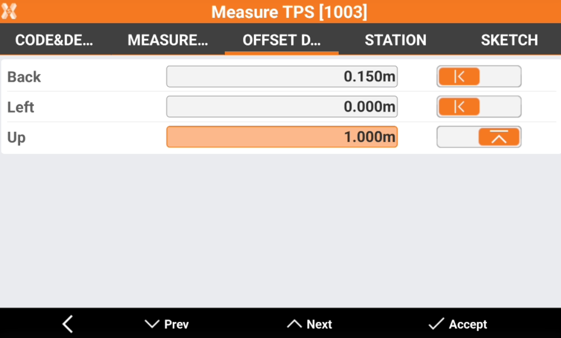
If a point has been measured with distance offset measure, the page Offset distance is available and shows the properties of the offset used in the measure.
-
Back/forward: the offset back or forward. Tap on on the arrow to change the offset direction.
-
Left/right: the offset left or right. Tap on on the arrow to change the offset direction.
-
Up/down: the offset up or down. Tap on on the arrow to change the offset direction.
-
It is possible to change the offset values to recalculate the point coordinate.
Offset (TPS only)
-
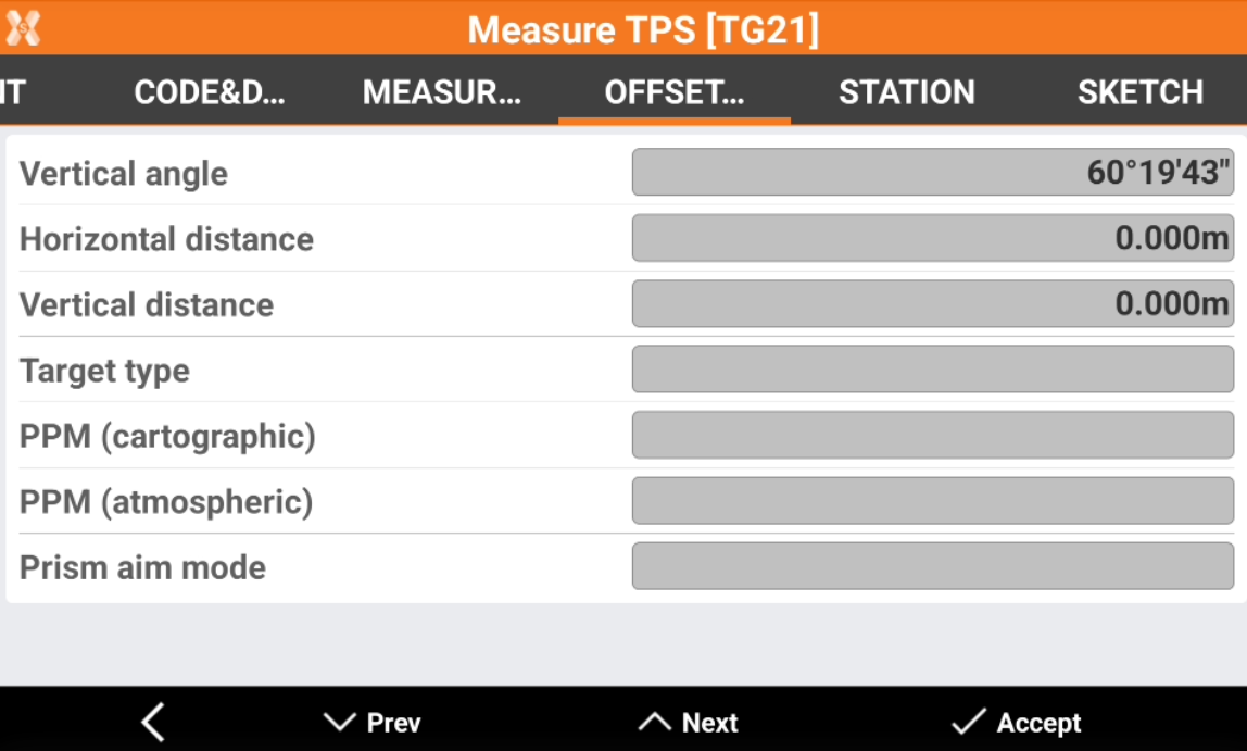
The Offset page is available in case the measurement is a total station measurement performed with an angular offset.
-
Vertical angle: in case of measurement with vertical angle offset, this field shows the vertical angle measured.
-
Horizontal angle: in case of measurement with horizontal angle offset, this field shows the vertical angle measured.
-
Reference (GPS only)
-
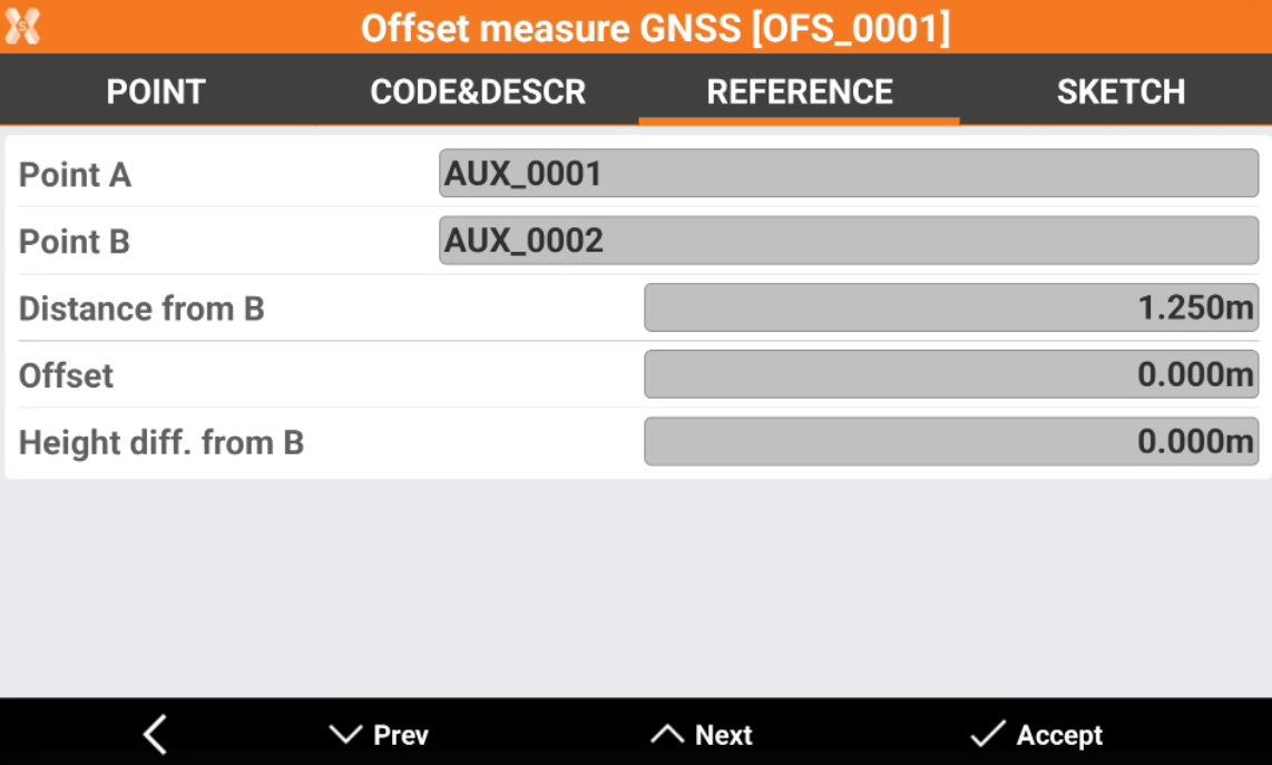
If a point has been measured with offset measurements (for example distance and alignment, or distance-distance), the Reference page shows the information regarding the used reference points.
-
Point A/B: the ID of the auxiliary points used.
-
Distance from: depending on the method used, the distance from the used auxiliary point.
-
Offset: depending on the method used, the offset from the used auxiliary point.
-
Atmospheric corrections (TPS only)
-
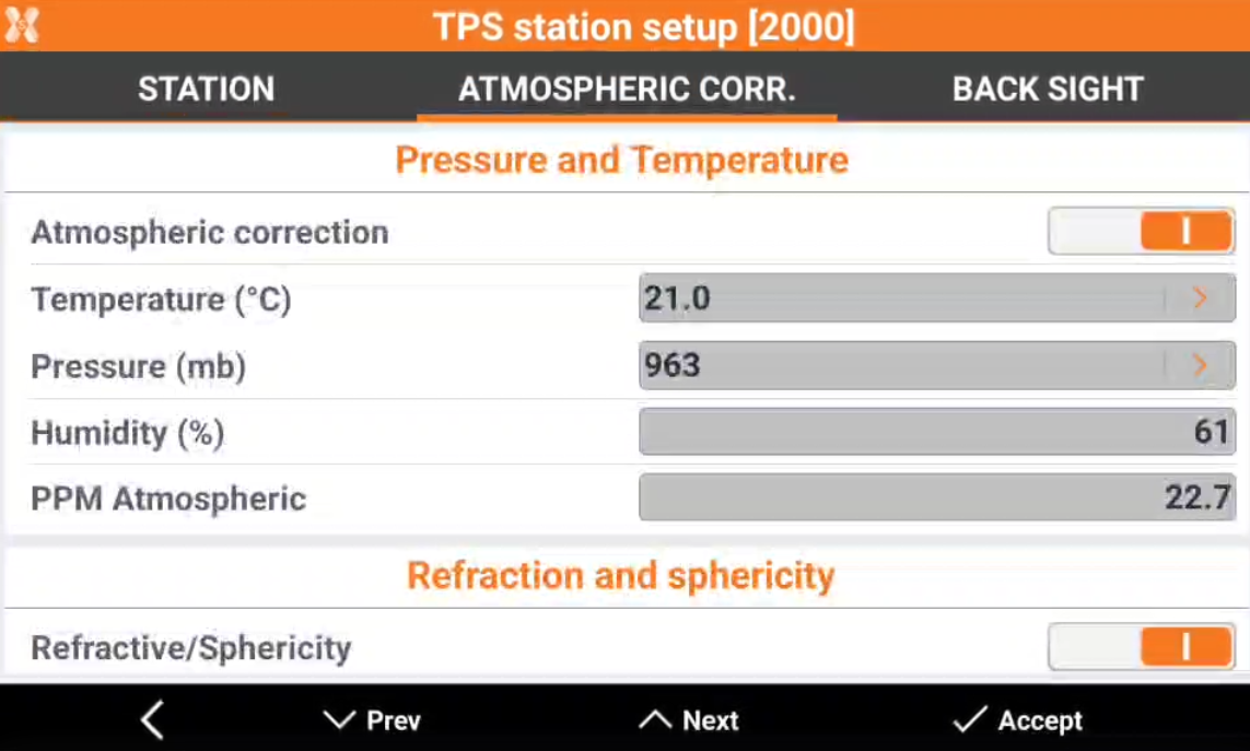
The Atmospheric corrections page is available for TPS station setup. The page shows the atmospheric corrections used for the measurements from this station and the refraction and sphericity parameters.
-
Atmospheric correction: shows if atmospheric corrections was used.
-
Temperature (°C): the temperature value in degrees Celsius.
-
Pressure (mb): the pressure value in millibar.
-
Humidity (%): the humidity value in percent.
-
Atmospheric PPM: the calculated PPM considering all parameters.
-
Refraction and sphericity: shows if refraction and sphericity parameters was used.
-
Refraction coeff.: value for the refraction.
-
Back sight (TPS only)
-
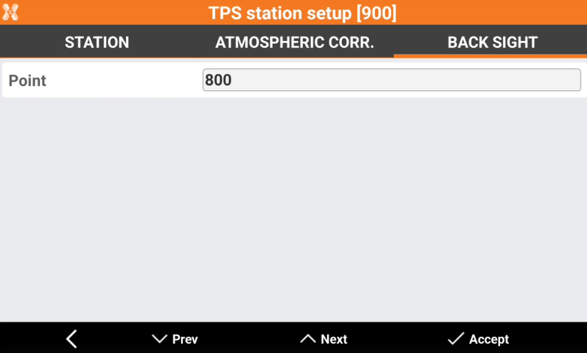
Th Back sight page is available for TPS station setup. The page shows the used back sight for the orientation.
-
Point: the point ID of the back sight point.
-
Free station (TPS only)
-
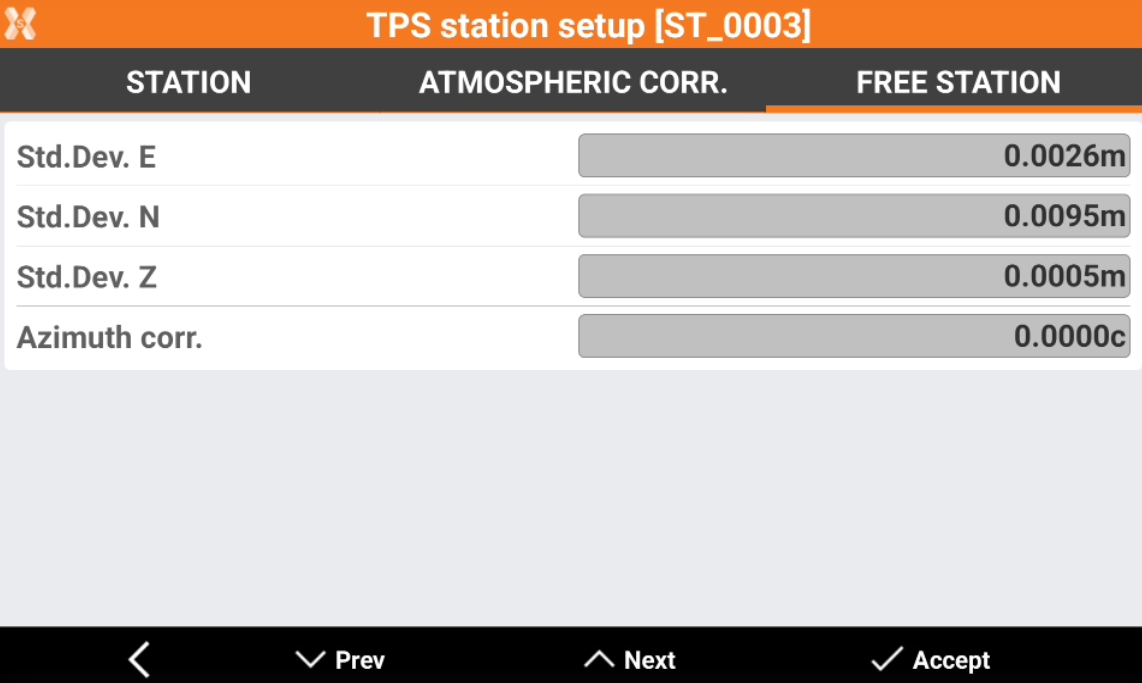
The Free station page is available for TPS stations setup in case the orientation is a free station. It shows the free station results.
-
Standard deviation E,N,Z: the value of the standard deviation in east, north and elevation.
-
Azimuth corr.: the applied azimuth correction.
Sketch
-
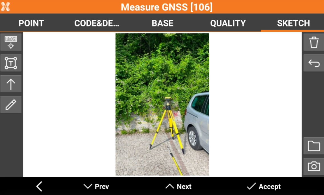
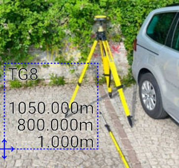
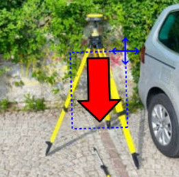
Sketch page allows to view the photo assigned to a point, load or take a new photo or draw on the image to have a picture of the topographic point.
-
-

-


-

-

-

-

-

-