



-
When measuring with a GNSS receiver, the rover is usually connected to a base to receive RTK corrections.
-
The software offers the possibility to change the GNSS base coordinate. This operation is for example common after post-processing the raw data from the base and obtaining more accurate coordinates. The coordinates of all other points in the job are updated.
-
Open the Job tab.
-
Select Points/Measurements/Codes.
-
Open the Measurements tab.
-
Select Tools to open the list of available tools.
-
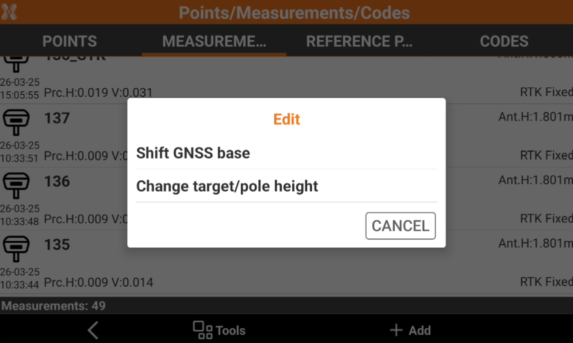
Select Edit and Shift GNSS base.
-
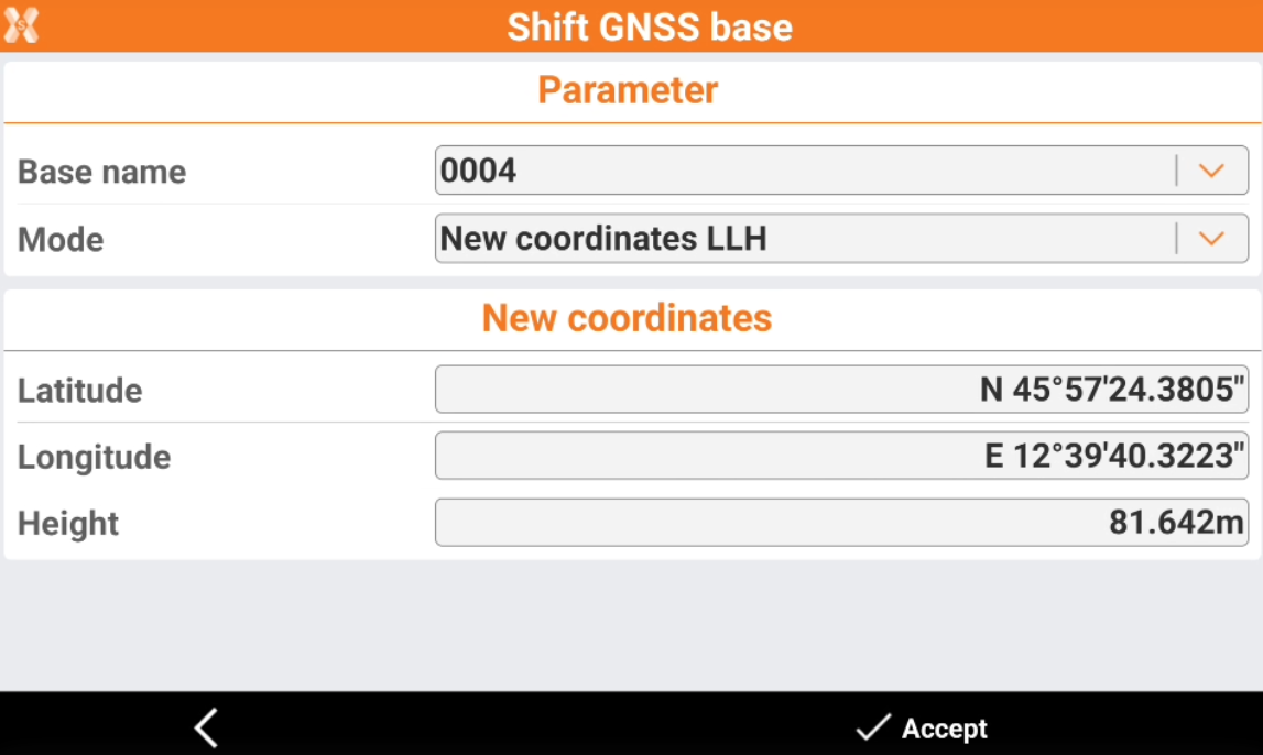
This opens the Shift GNSS base page.
-
Base name: lists the base points available in the job. Select the base point for which you want to enter new coordinates.
-
Mode: select how enter the new base coordinates.
-
New coordinates LLH: insert new values for longitude, latitude and height.
-
Latitude: new value for latitude.
-
Longitude: new value for longitude.
-
Height: new value for height.
-
-
Shifting values LLH: insert values for shifting in longitude, latitude and height.
-
Δ Latitude: shift value for latitude.
-
Δ Longitude: shift value for longitude.
-
Δ Height: shift value for height.
-
-
New coordinates ENZ: insert new values for east, north and elevation.
-
E: new value for east.
-
N: new value for north.
-
Z: new value for elevation.
-
-
Shifting values ENZ: to insert values for shifting in east, north and elevation.
-
Δ E: shift value for east.
-
Δ N: shift value for north.
-
Δ Z: shift value for elevation.
-
-
Updating base coordinate updates all points measured from the base.