


-
From Survey menu it is possible using a GNSS receiver or a total station to create or edit a surface measuring with the current instrument new triangles, boundary lines and break lines.
-
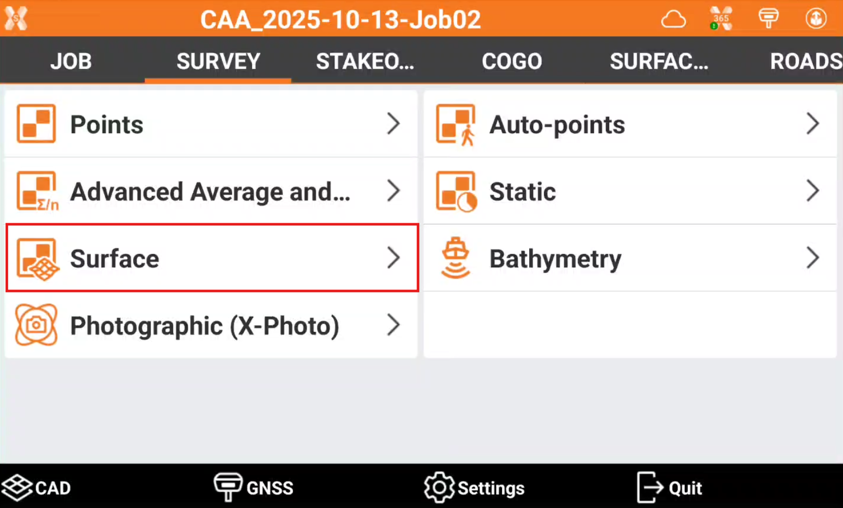
To survey a surface from the Survey page click Surface.
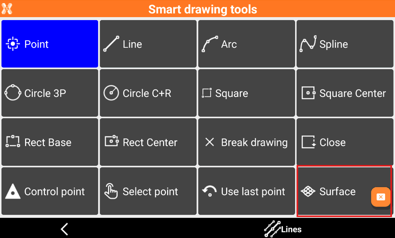
It is also possible to create points for a surface enabling the option in Smart Drawing Tools. This command allows to quickly add or create points to a surface using the Survey Point application.
-
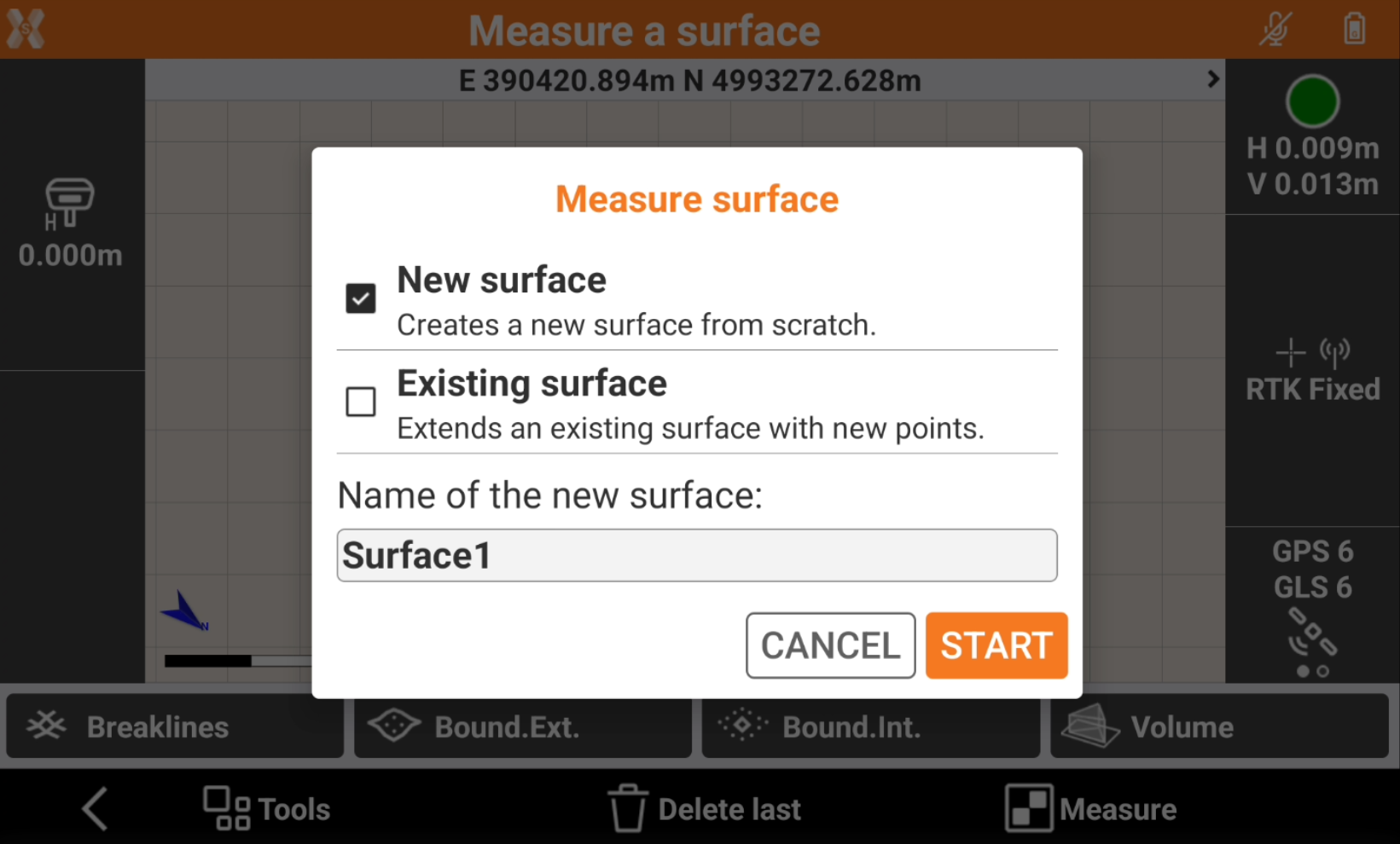
Select the surface to measure.
-
New surface: creates a new surface from scratch.
-
Existing surface: allows to edit an existing surface with new points, break lines and boundary lines.
-
-
Click Start.
-
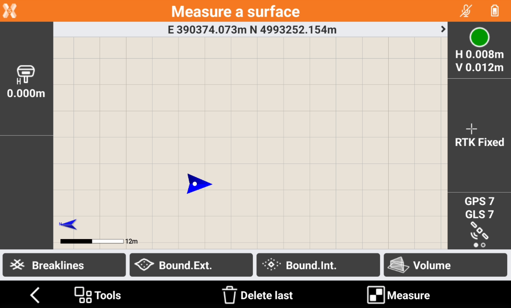
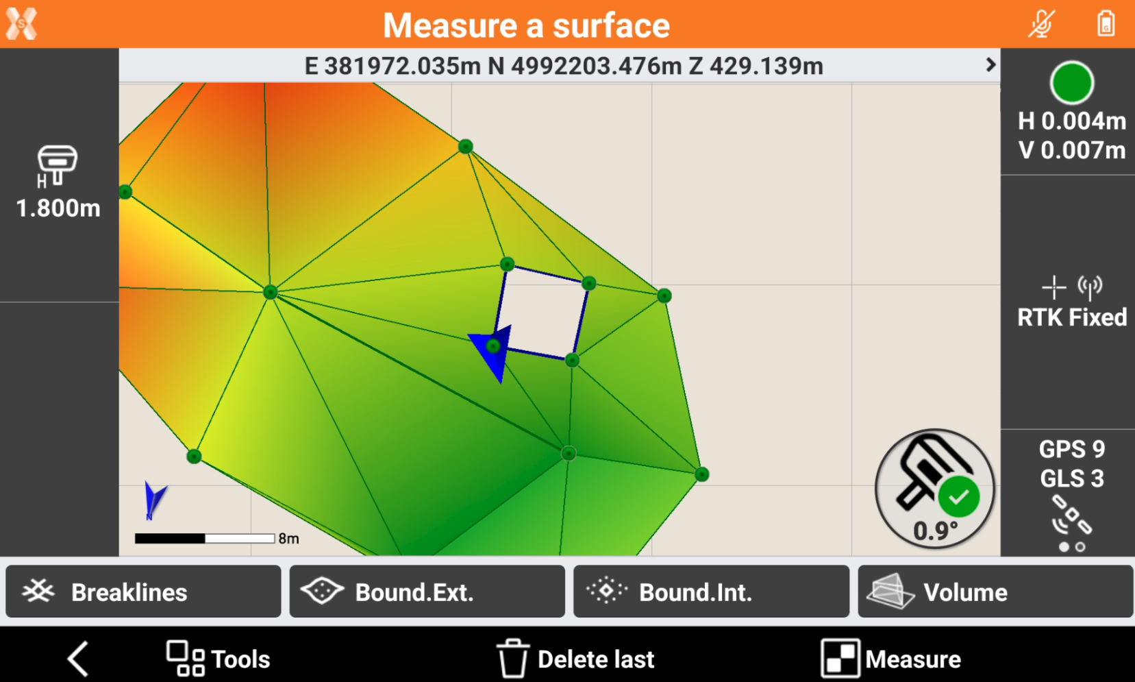
The commands in the bottom bar allow to measure the different surface elements:
-
Measure: to measure new topographic points to be used for the surface.
-
Breaklines: to survey a polyline as new break line to be used for the surface.
-
Bound Ext: to survey a polyline as new external boundary line to be used for the surface. When the points have been measured, press Stop to close the boundary line.
-
Bound Int: to survey a polyline as new internal boundary line to be used for the surface. When the points have been measured, press Stop to close the boundary line.
-
Delete last: to delete the last measured point.
-
-
The surface is generated and updated after each element is measured.
-
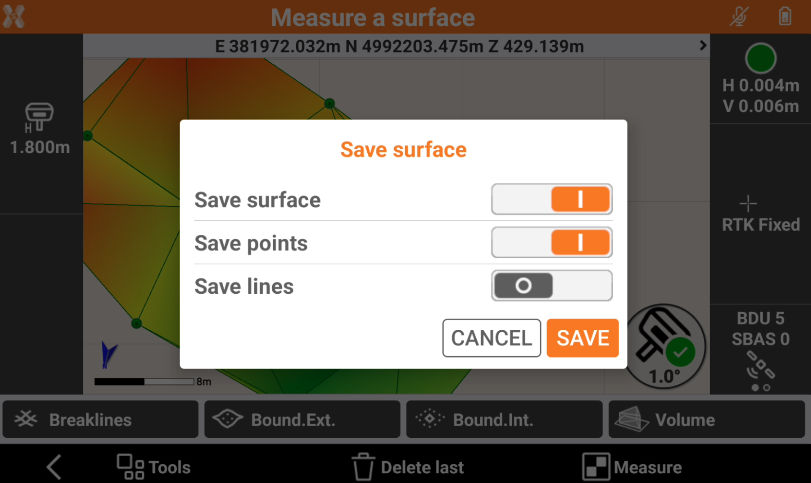
When the measurement operations are complete, click Back and select the elements to save.
-
Save surfaces: saves the surface inside the surface list of the current project.
-
Save points: saves the measured topographic points inside the current project.
-
Save lines: save the measured polylines inside the current project.
-
-
Click Save. The surface is saved inside the Surfaces list.