


-
The station has been placed on a point of known coordinates and the orientation is determined through the measurement of a known azimuth.
-
Select Yes. Station position is known.
-
Select Backsight by azimuth.
-
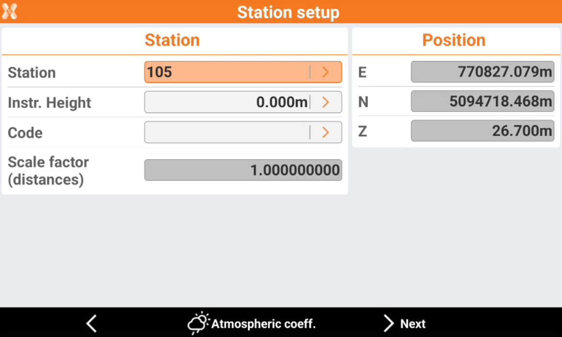
Station: name of the station. Select a point existing in the job.
-
Instrument height: elevation of the total station from the ground. It is possible to calculate the height of the instrument.
-
Code: code to assign to the station point in case a new point is created.
-
E, N, Z: coordinates of the station. When an existing point was selected, the values cannot be edited.
-
-
Click Atmospheric coeff to change the atmospheric coefficients.
-
Click Next to proceed to define the backsight point.
-
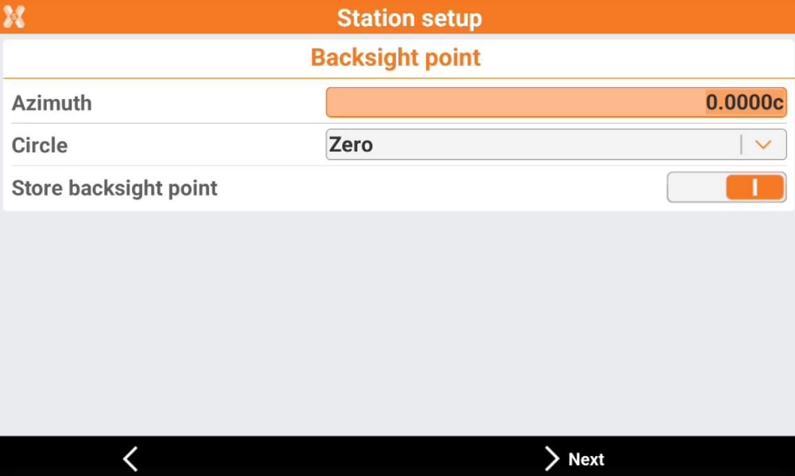
Azimuth: the azimuth between the position of the station and the reference point is calculated.
-
Circle: define how to set the horizontal angle of the station:
-
Current value: the angle of the station is not modified.
-
Zero: the angle of the station is reset to the reference point.
-
Azimuth: the angle of the station is set to the azimuth value.
-
-
Store backsight point: enables the storing in the point list of the backsight point.
-
Press Next to measure the backsight point.
-
-
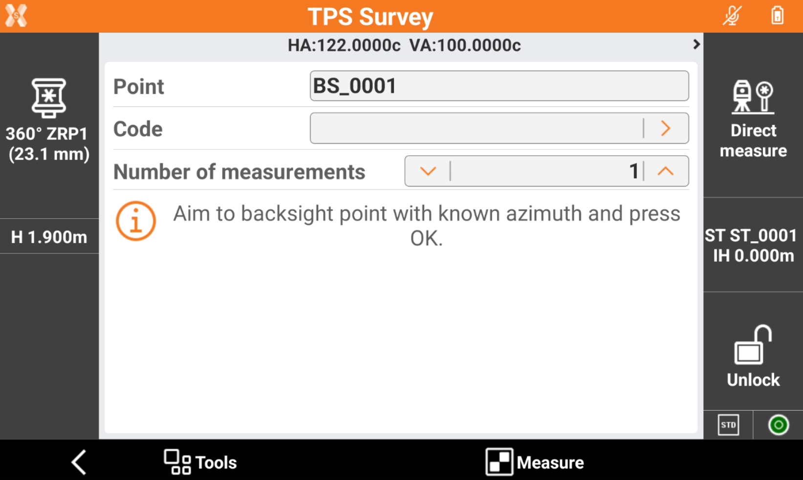
Aim the point of orientation.
-
Tap Measure.
-
The calculated data and the differences are displayed.
-
Tap Accept setup to confirm set data and complete procedure.