
-
Use the editing commands to create new topographic points or edit the CAD objects.
-
Open CAD.
-
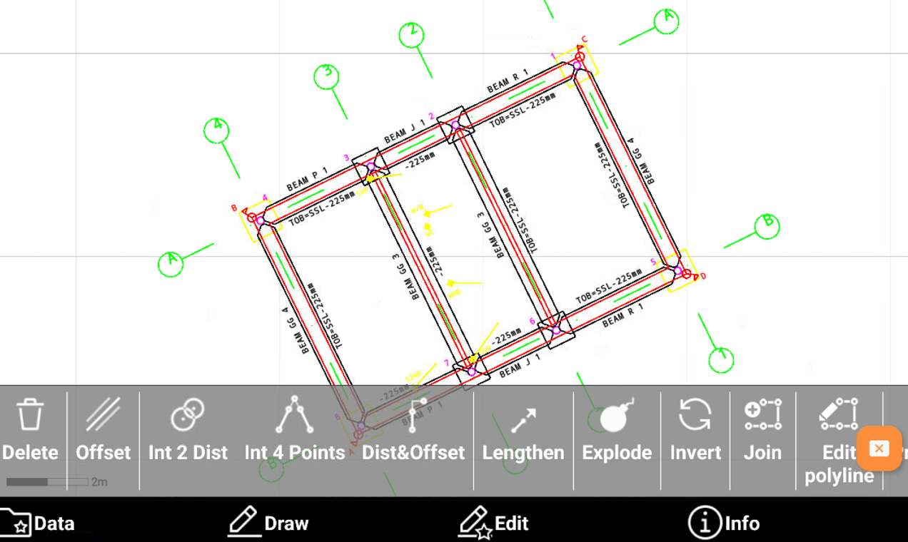
Click Edit to open the draw toolbar.
-
Delete: deletes CAD objects.
-
Offset: creates an object parallel to reference object at a defined distance.
-
Distance intersection: calculates the position of a new topographic point located at a certain distance from two reference points.
-
Intersection by 4 points: calculates the position of a topographic point that is on the intersection of two straight lines.
-
Distance and offset: calculates the position of a new topographic point referring to a reference object.
-
Lengthen: extends an object like a line, a polyline or an arc to a defined length. Or extend a line defined by two points which also indicates the direction where to create the point.
-
Explode: transforms selected polylines such as lines and circles into the base elements composing it.
-
Invert: reverses the vertex order of a drawing element.
-
Join: merges several entities so that they have one point in common. Example: Multiple lines that must be managed as a single polyline.
-
Edit polyline: allows to edit a polyline, for example inserting new vertexes, deleting a segment, inverting the polyline, etc.
-
Object properties: accesses the management of the graphical properties of the selected objects such as layer, colour and linetype.